Trail Walking Mont Lozère et Goulet - Tournel Oulmes - Photo
 gege30
gege30

User

© OpenStreetMap contributors
Length
Length
6.5 km
Max alt
Max alt
1115 m
Uphill gradient
Uphill gradient
219 m
Km-Effort
Km-Effort  
9.4 km
Min alt
Min alt
940 m
Downhill gradient
Downhill gradient
216 m
Boucle
Boucle
Yes
Creation date :
2019-05-22 12:26:03.356
Updated on :
2019-06-09 14:46:38.164

(0 Reviews)

Walking
Walking
2h40
Difficulty : Easy

Scan this QR Code to open this trail in the SityTrail application

FREE GPS app for hiking

Logo SityTrail SityTrail

IGN / Geographical institutes

Download SityTrail from the App Store Download SityTrail from Google Play

Logo SityTrail SityTrail World

The world is yours!

Download SityTrail from the App Store Download SityTrail from Google Play Download SityTrail on Huawei AppGallery

About

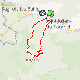
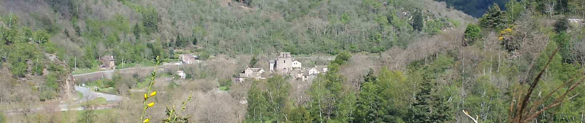
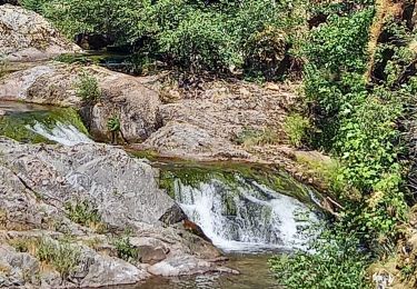
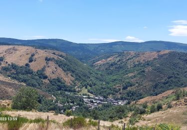
Trail Walking of 6.5 km to be discovered at Occitania, Lozère, Mont Lozère et Goulet. This trail is proposed by gege30.

Description

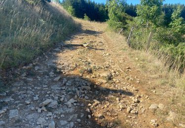
Parking après pont sur route d'Oulmes .Revenir avant ce pont et emprunter à droite l'itinéraire  "des coutinettes" pour remonter le rieu frech  , passerelle et atteindre Oulmes et son clocher de tourmente puis descendre en suivant les coutinettes  vers le bas quitter à droite pour rejoindre parking

Elevation profile

Photos

Positioning

Country:
France
Region :
Occitania
Department/Province :
Lozère
Municipality :
Mont Lozère et Goulet
Location:
Unknown
Start:(UTM)
553872 ; 4927866 (31T) N.

Trails nearby

Trail Walking Mont Lozère et Goulet - Bleymar _ Le Pont Montvert - Photo
Walking
MoulinPierrick

Walking

Difficult
(1)
Mont Lozère et Goulet, Occitania, Lozère, France
22 km | 32 km-effort
5h 19min
No
Trail Walking Mont Lozère et Goulet - Chemin de Stevenson - Le Bleymard vers Le Pont de Montvert - Photo
Walking
tracegps

Walking

Difficult
(1)
Mont Lozère et Goulet, Occitania, Lozère, France
18.9 km | 28 km-effort
4h 30min
No
Trail Walking Mont Lozère et Goulet - Stevenson étape 8 - Photo
Walking
GUIDE
nadinebondoux

Walking

Difficult
Mont Lozère et Goulet, Occitania, Lozère, France
20 km | 30 km-effort
5h 29min
No
Trail Walking Mont Lozère et Goulet - Le Bleymard_La Crouzette par le chemin Stevenson_10,5Km - Photo
Walking
Pousscailleux

Walking

Difficult
(1)
Mont Lozère et Goulet, Occitania, Lozère, France
10.6 km | 14.4 km-effort
3h 2min
Yes
Trail Other activity Mont Lozère et Goulet - lundi - Photo
Other activity
olivier78000

Other activity

Medium
(1)
Mont Lozère et Goulet, Occitania, Lozère, France
10.3 km | 14.5 km-effort
3h 29min
No
Trail Walking Mont Lozère et Goulet - Château de Tournel - Photo
Walking
nolsim

Walking

Medium
Mont Lozère et Goulet, Occitania, Lozère, France
14.1 km | 22 km-effort
7h 25min
Yes
Trail Walking Mont Lozère et Goulet - Etape 6 le Bleymard  / Pont Montvert - Photo
Walking
Nathalie. Mercier

Walking

Difficult
Mont Lozère et Goulet, Occitania, Lozère, France
20 km | 29 km-effort
5h 31min
No
Trail Mountain bike Mont Lozère et Goulet - Fait GTMC 2022 E3  3b - Photo
Mountain bike
jl77130

Mountain bike

Difficult
Mont Lozère et Goulet, Occitania, Lozère, France
51 km | 68 km-effort
7h 43min
No
Trail Walking Mont Lozère et Goulet - Pont de Montvert  - Photo
Walking
jeanjean35

Walking

Very difficult
Mont Lozère et Goulet, Occitania, Lozère, France
19.4 km | 29 km-effort
6h 52min
No


Close
My subscriptions